This item doesn’t have any media yet
2017 | Travel
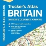
Fully updated for 2018, the atlas includes truck and freight ferry port plans, route planner map, distance chart and 12-page London mapping section showing height, width and weight restrictions. Minor roads more than 4 metres wide and less than 4 metres wide are identified, as well as road tunnels, toll roads, steep gradients and level crossings. Additional features include a special spread on how to avoid striking a bridge, plus Network Rail's 22 most frequently struckbridges. Feature on height restriction road signs, the safety clearance code and large scale district maps of London, Birmingham, Glasgow, Manchester and Newcastle.
| Published by | AA Publishing |
| Edition | Unknown |
| ISBN | 9780749578855 |
| Language | N/A |
Images And Data Courtesy Of: AA Publishing.
This content (including text, images, videos and other media) is published and used in accordance
with Fair Use.