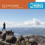
Ben Nevis and Fort William, the Mamores and the Grey Corries, Kinlochleven and Spean Bridge
BookThis item doesn’t have any media yet
2015 | Sport & Leisure
OS Explorer is the Ordnance Survey's most detailed map and is recommended for anyone enjoying outdoor activities like walking, horse riding and off-road cycling. The OS Explorer range now includes a digital version of the paper map, accessed through the OS smartphone app, OS Maps. Providing complete GB coverage the series details essential information such as youth hostels, pubs and visitor information as well as rights of way, permissive paths and bridleways.
Related Items:
| Published by | Ordnance Survey |
| Edition | Unknown |
| ISBN | 9780319246351 |
| Language | N/A |
Images And Data Courtesy Of: Ordnance Survey.
This content (including text, images, videos and other media) is published and used in accordance
with Fair Use.
