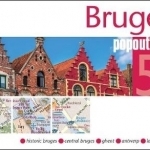
Bruges PopOut Map
BookThis item doesn’t have any media yet
2017 | Travel
Explore the medieval magic of Bruges with the help of this genuinely pocket-sized, pop-up map. Small in size, yet big on detail, this compact, dependable Bruges city map will ensure you don't miss a thing. *Includes two pop-up maps covering historic and central Bruges *Additional maps covering Antwerp, Ghent and a locator map are also included *3 recommended walking tours are included on the central Bruges map *Handy, self-folding tourist map is small enough to fit in your pocket yet offers extensive coverage of the city in an easy-to-use format *Thorough street index is also featured and cross-referenced to the map so you can easily find your destination *Hotels, restaurants, stores and attractions are all included What's new for this edition?
* New map of central Bruges showing even greater detail of the Bruges central historic area * Maps have been re-orientated for even greater ease of use * Stunning photographs of the Top 10 sights are now included on the maps to give you a flavour of what you'll see on your trip * Each walking tour now includes additional information giving you a taste of what you'll see on the tour, how long it will take and the distance in miles and kilometres Ideal to pop in a pocket or bag for quick reference while exploring the city. Contents include maps of Historic Bruges, Central Bruges, Antwerp, Ghent and a Bruges locator map. Fold size: 95mm x 130mm (3.75" x 5.25") Sheet size: 215mm x 225mm (8.5" x 9.75") per sheet; 2 sheets Approx scale: 1:4000 (Historic Bruges) 1:14000 (Central Bruges); Scale is to be used as a guideline only.
Related Items:
| Published by | Compass Maps |
| Edition | Unknown |
| ISBN | 9781910218310 |
| Language | N/A |
Images And Data Courtesy Of: Compass Maps.
This content (including text, images, videos and other media) is published and used in accordance
with Fair Use.
