This item doesn’t have any media yet
2016 | Travel
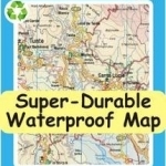
Water-proof, split-proof, tear-proof, adventure-proof. Gran Canaria Tour & Trail Super-Durable Map is simply the toughest, most accurate, easy to read, easy to use map of the island you can buy at any price. David & Ros Brawn have partnered with Gran Canaria's hiking experts 'Rambling Roger', Isabelle and Dane; five researchers with mapping gps units who have surveyed Gran Canaria in detail to produce this map. New for our 3rd Edition are new style highlighting of official and Rambling Roger walking trails making these trails easier to find on the map and easier to follow on the ground, along with a comprehensive updating by our trio of hikers. The official network of hiking trails are highlighted in green, plus 'Rambling Roger's' walking trails are highlighted in red. Large, 50k scale, easy to read map sheets include a wealth of useful details. 20 metre and 100 metre contours combined with altitude shading bring these impressive landscapes to life.
All of the legendary Tour & Trail attention to detail is included so that you will find those petrol stations, mirador viewpoints with parking, refreshment stops with parking and accurate road numbering that are so essential when adventuring by hire car. 'Off-Tarmac' Gran Canaria Tour & Trail Map is in a league of its own thanks to all the hiking trails and dirt tracks surveyed by Roger, Isabelle and Dane. Rambling Roger's walking trails from his two guide books are highlighted in red making this map and Roger's books perfect for your walking adventures. 'Super-Durable' means a waterproof, tear-proof, map that can take the roughest treatment and still folds up like new after your adventures. Printed on Polyart using specialist 100% oxygenation inks produces a lightweight map that feels like silk but is a tough as old boots as it shrugs off water, resists tearing and damage better than any other map. 'Super-Durable' combined with our special concertina map fold means this 'near indestructible' Tour & Trail Map unfolds easily for use, and more importantly folds back up easily to its compact pocket size even after the toughest use.
Custom Map digital edition for Garmin users is available from Discovery Walking Guides website dwgwalking.co.uk plus digital editions are available for gps apps from Viewranger and MyTrails. Tour & Trail Super-Durable Maps are printed on Polyart using 100% oxygenation inks which produces a lighweight map that feels like silk while being both water-proof and incredibly tough so that after even the toughest of adventures your Tour & Trail Super-Durable Map will fold up like new. Polyart is made of high-density polyethylene (HDPE) and is therefore 100% recyclable in category 2 HDPE. For more information see the Polyart website.
| Published by | Discovery Walking Guides Ltd |
| Edition | Unknown |
| ISBN | 9781782750321 |
| Language | N/A |
Images And Data Courtesy Of: Discovery Walking Guides Ltd.
This content (including text, images, videos and other media) is published and used in accordance
with Fair Use.