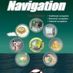
Illustrated Navigation - Traditional, Electronic & Celestial Navigation
BookThis item doesn’t have any media yet
2017 | Sport & Leisure
Today, yachts are often equipped with radar, GPS, chart plotters, AIS, etc. This equipment has also become much more reliable, making it possible to make long offshore passages without a great knowledge of navigation. However, such equipment can be set up wrongly, interpreted incorrectly, malfunction or lose power. In these circumstances, knowledge of traditional navigation can become extremely important. This book will teach you how to navigate in the traditional way using compass, log and plotter; and also how to navigate using electronic aids like GPS, radar and chart plotter. In addition, you will learn some basic celestial navigation using the sun and stars to obtain your position using sextant, almanacs, tables and a watch. Each method of navigation is explained alongside detailed illustrations and examples, combining to make a straightforward and easy-to-follow guide.
Related Items:
| Published by | Fernhurst Books Limited |
| Edition | Unknown |
| ISBN | 9781909911581 |
| Language | N/A |
Images And Data Courtesy Of: Fernhurst Books Limited.
This content (including text, images, videos and other media) is published and used in accordance
with Fair Use.
