This item doesn’t have any media yet
2016 | Travel
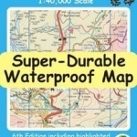
Fully detailed Mallorca adventures with our new Mallorca North & Mountains Tour & Trail Super-Durable Map 6th edition by David Brawn and Walk! Mallorca guide book by Charles Davis. Our new 6th edition gives you a super detailed, up to date, map of the Tramuntana region stretching from Peguera-Costa Calma- Santa Ponca in the west then running along the mountainous region to the very tip of the Formentor peninsula at Cap Formentor. With a size of 1,080mm by 600mm at 40,000 scale on a double sided map sheet you get a lot of Mallorca on this map while still being easy to read thanks to our Tour & Trail design standards. Those essential features of petrol stations, refreshment stops, miradors and off-road parking are easily seen while our background altitude shading plus 50 and 100 metre contours and spot heights bring this beautiful landscape to life. Special 'concertina map fold' means your map unfolds quickly, and more importantly folds back to its compact pocket size easily and quickly.Super-Durable means we have printed the map on 'Polyart' to produce a lightweight map that feels like silk but is as tough as old boots to outlast the worst of conditions and fold up like new after every use.
All the 53 walking routes from our Walk! Mallorca guide book and the route of the GR221 long distance trail are specially highlighted making these walking routes easier to find on the map and easier to follow on the ground. If you are planning Mallorca adventures on and around the Tramuntana then this is the essential map for you.
| Published by | Discovery Walking Guides Ltd |
| Edition | Unknown |
| ISBN | 9781782750291 |
| Language | N/A |
Images And Data Courtesy Of: Discovery Walking Guides Ltd.
This content (including text, images, videos and other media) is published and used in accordance
with Fair Use.