This item doesn’t have any media yet
2016 | Sport & Leisure
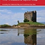
This is in the series of official pocket sized, folded maps to the National Cycle Network which include clearly mapped on-road and traffic-free paths, easy to read contours and detailed town insets. The series is published by Sustrans. 1:110,000 scale; folded 155mm x 99mm; flat 792mm x 630mm.Oban, Kintyre & The Trossachs Cycle Map 42. Including the Caledonia Way and 2 individual day rides.
| Published by | Sustrans |
| Edition | Unknown |
| ISBN | 9781910845189 |
| Language | N/A |
Images And Data Courtesy Of: Sustrans.
This content (including text, images, videos and other media) is published and used in accordance
with Fair Use.