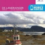
Raasay & Applecross, Loch Torridon & Plockton
BookThis item doesn’t have any media yet
2016 | Sport & Leisure
The OS Landranger Map series covers Great Britain with 204 detailed maps, perfect for day trips and short breaks. Each map provides all the information you need to get to know your local area and includes places of interest, tourist information, picnic areas and camp sites, plus Rights of Way information for England and Wales. OS Landranger now includes a digital version of the paper map, accessed through the OS smartphone app, OS Maps.
Related Items:
| Published by | Ordnance Survey |
| Edition | Unknown |
| ISBN | 9780319261224 |
| Language | N/A |
Images And Data Courtesy Of: Ordnance Survey.
This content (including text, images, videos and other media) is published and used in accordance
with Fair Use.
