This item doesn’t have any videos yet
Add New VideoNavigation | Photo & Video
iOS
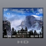
***** 40%-OFF SALE ***** Theodolite HD is on sale for 40%-off to celebrate its seven year anniversary! ***** As seen in Apple's iPad Special Event Keynote, Theodolite HD is a multi-function viewfinder for iPad and iPad mini that combines a compass, two-axis inclinometer, rangefinder, GPS, map, nav calculator, tracker, and geo-tag photo/movie camera into one indispensable app. Uses are endless, and the app is great for hiking, boating, hunting, golf, outdoor sports, sightseeing, navigation, and finding your way around. Theodolite is used extensively by surveyors, geologists, architects, engineers, competitive sportsmen, first responders, military personnel, and search and rescue workers around the world.
Theodolite lets you take geo-tagged camera images, screenshots, movies, and screen movies directly from the app, with 2X and 4X digital zoom and fast buffered saves. You can choose to overlay geographical data, time, date, and custom notes directly on photos and movies for later reference.
View your current position on the built in map view, with optional new Outdoors maps that include topo contours (feet or meters), roads, trails, landmarks, campgrounds, ski lifts, and more. Custom "live" map markers continually update distance/heading relative to the current location. Share map markers and nav calculator points with other users of Theodolite and Theodolite HD via SMS text messages and e-mail. This powerful capability opens up a wide range of collaborative uses which include team land surveying, accident investigations, spotting of wild fires, triangulation of landmarks, and advanced tactical observation and targeting operations.
Theodolite includes features for serious users like a reference angle mode, a nav calculator, data logging, e-mail export with KML, system-wide clipboard integration, percent grade display, mil compass readout, optical rangefinders (including a mil-based reticle, sniper-style stadiametric graphs, and a variable 4X-24X scope), and colored lens filters to improve use in dark conditions and preserve night vision. The app can provide location in military grid reference system (MGRS) coordinates, universal transverse Mercator (UTM) coordinates, British/Irish National Grids, US National Grid, and six latitude/longitude formats.
Optional US State Plane coordinates include SPCS27 and SPCS83 zones covering all US States. The optional Datum Pack adds over 230 geodetic datums to the app for more accurate position and altitude computation from GPS data, covering regions and countries on all continents around the world.
With an optional in-app purchase to enable team tracking, you can share location with up to 20 people on Theodolite's map. Team tracking was developed in conjunction with search and rescue teams to offer a good balance between simplicity and performance.
Theodolite has been featured several times in iTunes in "Rewind: Hot Trends in Apps", "The World Around You", and "New and Noteworthy". It has been a #1 selling Navigation app in App Stores around the world. Since its introduction in 2009, Theodolite has defined augmented reality navigation. The app continually introduces new technologies, pushing the limits of iOS app development.
Find out why Apple named Theodolite one of the most amazing apps available and showed it being used to explore the Great Wall of China. Where will you take it on your next adventure?
Theodolite HD requires a camera-equipped iPad or iPad mini (see the regular Theodolite app for use on iPhone and iPod Touch). Note: GPS requires an iPad with 3G or 4G cellular data capability. WiFi-only iPads do not have GPS hardware.
| Published by | Craig Hunter |
| Developed by | Hunter Research and Technology, LLC |
| Certificate | 4+ |
| Languages | English |
| Compatibility | iPad |
Images And Data Courtesy Of: Craig Hunter.
This content (including text, images, videos and other media) is published and used in accordance
with Fair Use.