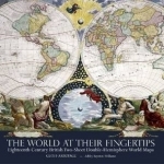
The World at Their Fingertips: Eighteenth-century British Two-sheet Double-hemisphere World Maps
BookThis item doesn’t have any media yet
2012 | History & Politics
Between 1680 and 1807 British publishers produced a sequence of double-hemisphere world maps each printed on two sheets and conjoined. These maps are a peculiarly British phenomenon of this period and they provide a key indicator of the way the British map trade specifically targeted a newly prosperous and upwardly aspiring class of purchasers. The buyers were hungry for geographical information, but were also eager to acquire such maps for display, as a statement of their intellectual pursuits. The scientific appearance of the maps was more important as a selling point than standards of contemporary geographical accuracy, which few of them achieved. This is the first time that this type of map has been studied as a genre, partly because of their great rarity. The British Library holds the most comprehensive collection of these maps and studying them together has enabled the identification of broader themes. In particular, a greater understanding of the British map trade in the 18th century, its business practices, the economics of map-making and new techniques of marketing emerges.
Related Items:
| Published by | The British Library Publishing Division |
| Edition | Unknown |
| ISBN | 9780712358774 |
| Language | N/A |
Images And Data Courtesy Of: The British Library Publishing Division.
This content (including text, images, videos and other media) is published and used in accordance
with Fair Use.
